


 Standard Datasets
Lane Merging and Fork Area Segmentation Dataset
Welcome to the fascinating world of autonomous driving, powered by our rich and diverse datasets. These datasets, meticulously curated and annotated, are the lifeblood of the self-driving car industry, fueling advancements across various domains.
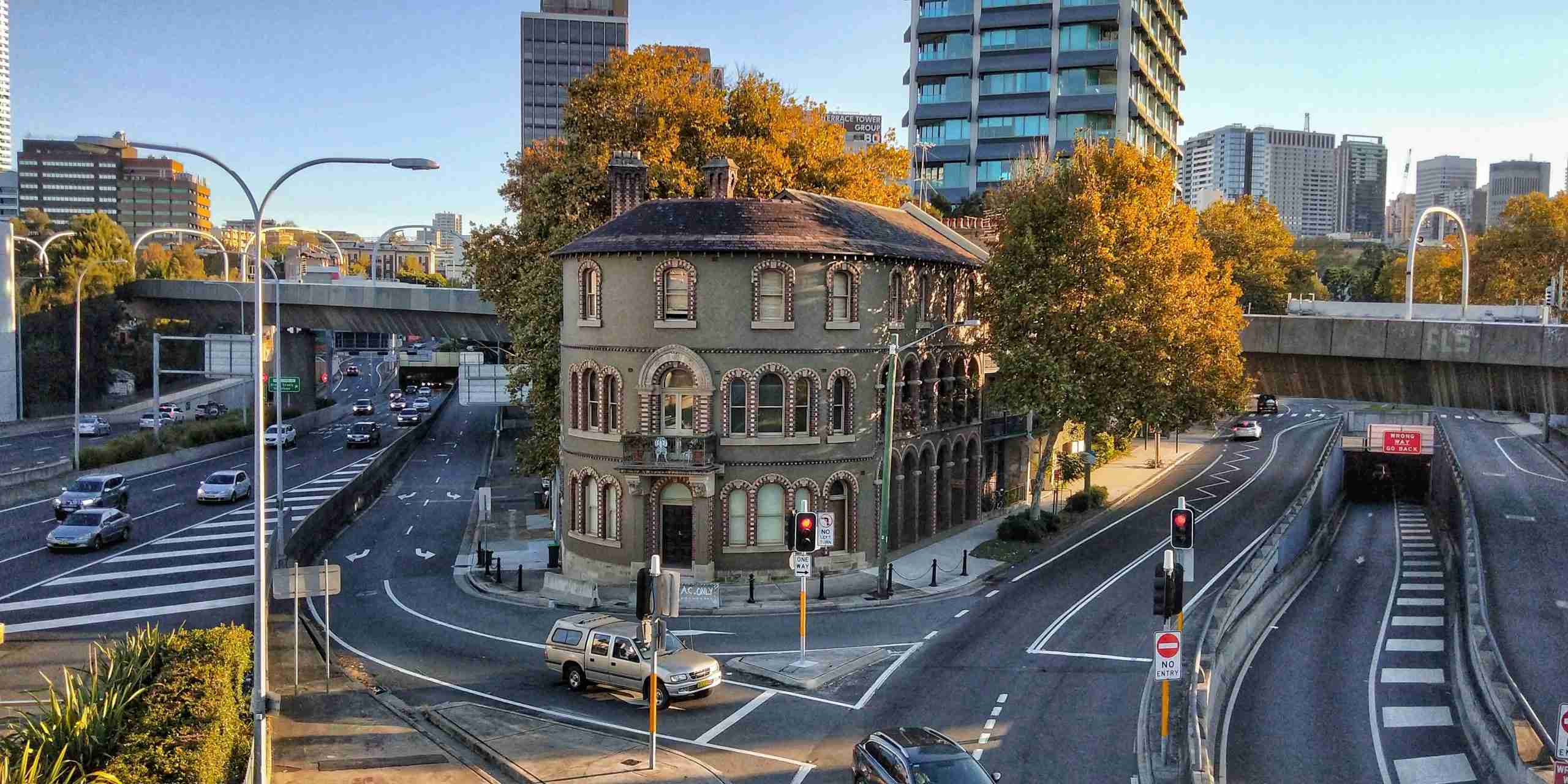
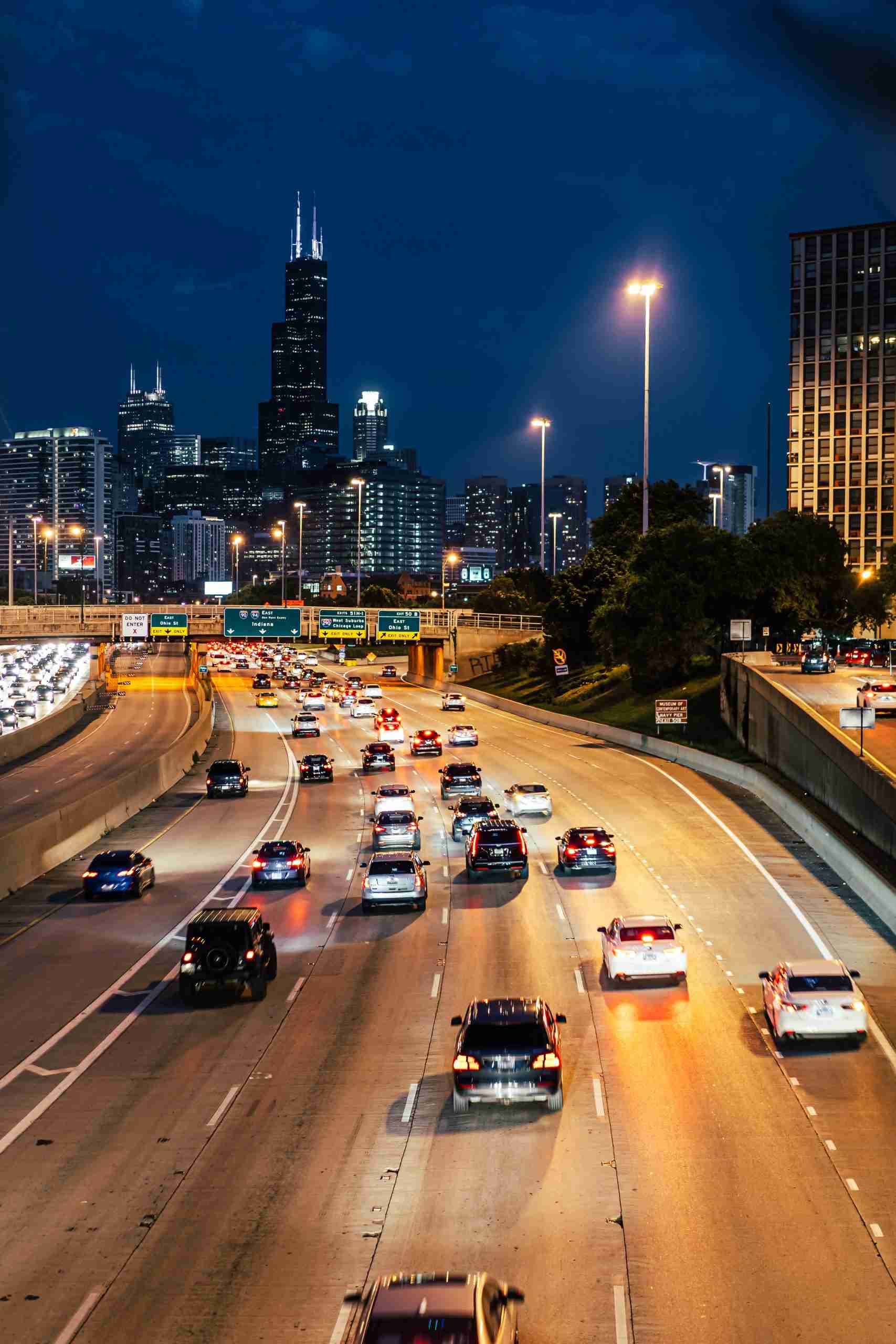
The "Lane Merging and Fork Area Segmentation Dataset" specifically addresses the complexities of lane merging and forking, critical scenarios in autonomous driving. This dataset, consisting of driving recorder images, is annotated for binary segmentation, focusing on areas where lanes merge or branch off. It includes detailed labels for lane merging areas, lane fork areas (marked by triangular inverted lines), and potential obstructions such as vehicles, trees, road signs, and pedestrians. This dataset is a vital tool for training AI models to navigate these challenging road situations, ensuring smoother and safer autonomous driving experiences.
Sample


Specification
Dataset ID
MD-Auto-004
Dataset Name
Lane Merging and Fork Area Segmentation Dataset
Data Type
 Image
ImageVolume
About 4.2k
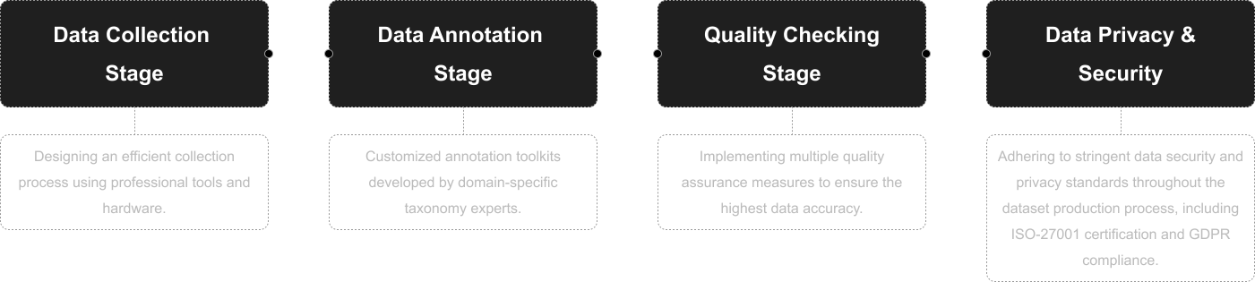
Data Collection
Driving recorder images
Annotation
Binary Segmentation
Annotation Notes
Labels include areas of lane merge, areas of lane branches (areas with triangular inverted lines). They include obstructions and obstacles, such as vehicles, trees, road signs, pedestrians, and so on.
Application Scenarios
Autonomous Driving
Data Collections
With around 4.2k images, this dataset provides insights into the dynamic and complex environments of lane merging and forking. Each image is precisely annotated to capture the nuances of these areas, including surrounding obstacles. This focused dataset empowers the development of sophisticated autonomous driving systems capable of understanding and reacting to intricate road configurations and hazards.
Quality Assurance
Relevant Open Datasets
To supplement this Dataset, you can explore these open datasets for additional resources:
Cityscapes Dataset [Learn more]
Focuses on semantic understanding of urban street scenes, featuring semantic, instance-wise, and dense pixel annotations for various classes. It includes 5,000 finely annotated images and 20,000 coarsely annotated images.
Waymo Open Dataset [Learn more]
Offers a high-quality multimodal sensor dataset for autonomous driving extracted from Waymo self-driving vehicles, covering a wide variety of environments and conditions.
nuScenes Dataset [Learn more]
A comprehensive dataset for autonomous driving that enables researchers to study urban driving situations using the full sensor suite of a real self-driving car. The dataset features camera images, lidar sweeps, and detailed map information.
A2D2 Dataset [Learn more]
The Audi Autonomous Driving Dataset (A2D2) offers a large volume of data with various annotations, including semantic segmentation and 3D bounding boxes.
Related products
Any further information, please contact us.
