


 Standard Datasets
Drivable Area Segmentation Dataset
Welcome to the fascinating world of autonomous driving, powered by our rich and diverse datasets. These datasets, meticulously curated and annotated, are the lifeblood of the self-driving car industry, fueling advancements across various domains.
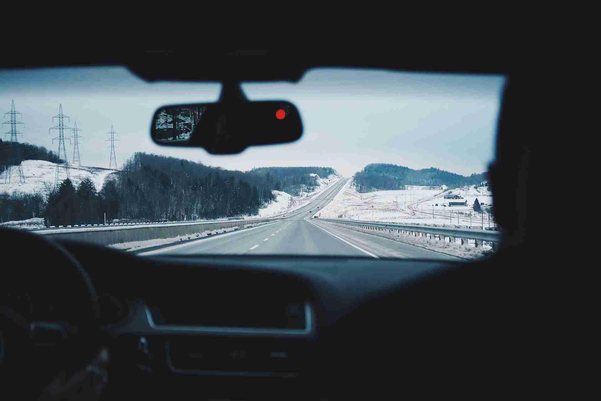
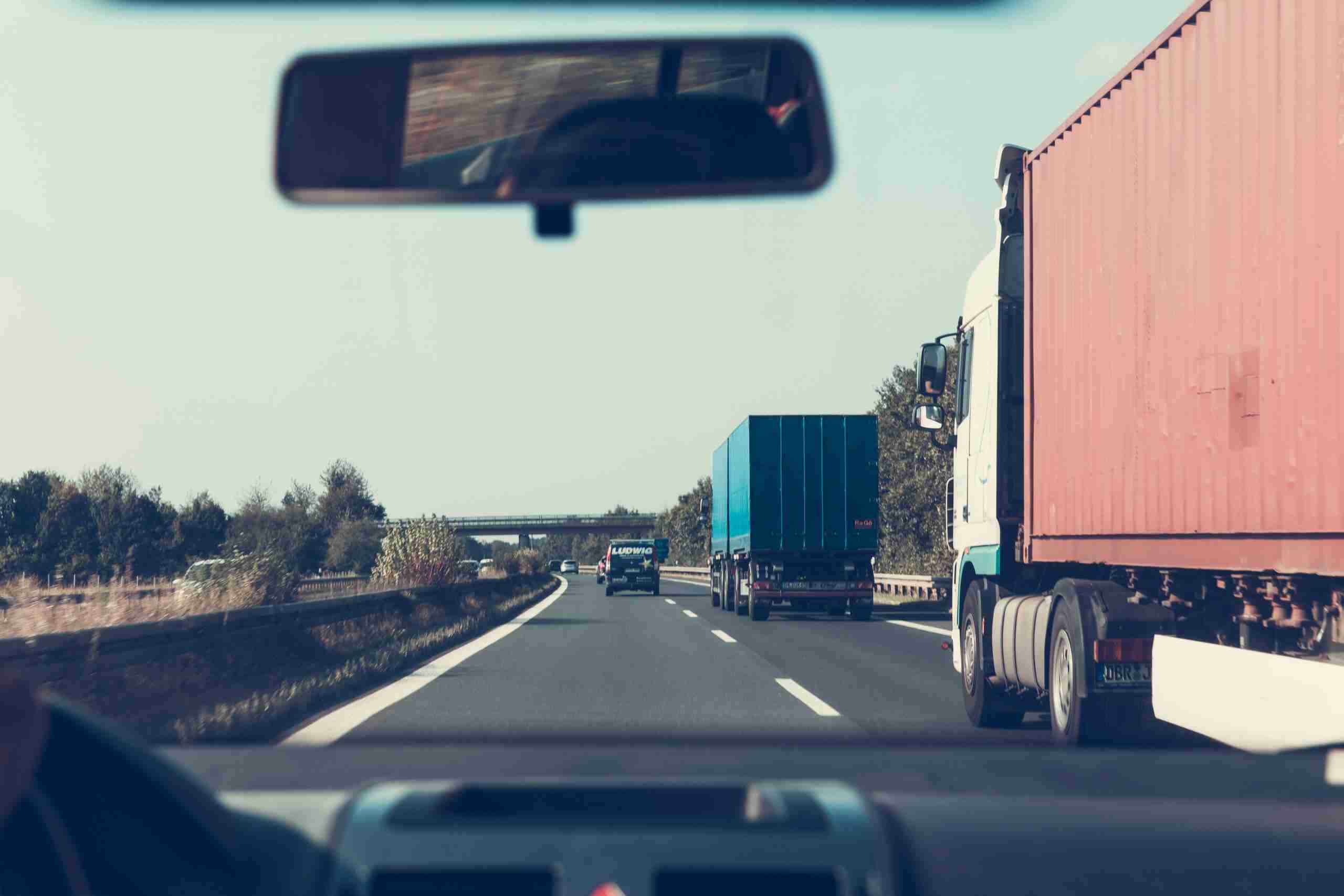
The "Drivable Area Segmentation Dataset" is meticulously crafted to enhance the capabilities of AI in navigating autonomous vehicles through diverse driving environments. It features a wide array of high-resolution images, with resolutions ranging from 1600 x 1200 to 2592 x 1944 pixels, capturing various pavement types such as bitumen, concrete, gravel, earth, snow, and ice. This dataset is vital for training AI models to differentiate between drivable and non-drivable areas, a fundamental aspect of autonomous driving. By providing detailed semantic and binary segmentation, it aims to improve the safety and efficiency of autonomous vehicles, ensuring they can adapt to different road conditions and environments encountered in real-world scenarios.
Sample


Specification
Dataset ID
MD-Auto-001
Dataset Name
Drivable Area Segmentation Dataset
Data Type
 Image
ImageVolume
About 115.3k
Data Collection
Recording picture of driving recorder. Resolution ranges from 1600 x 1200 to 2592 x 1944
Annotation
Semantic Segmentation,Binary Segmentation
Annotation Notes
The area taken by the driving recorder in the driver's view. Pavement types include bitumen, concrete, gravel, earth, snow, ice, etc.
Application Scenarios
Autonomous Driving
Data Collections
Comprising approximately 115.3k annotated images, this dataset offers a comprehensive view of the road from the perspective of driving recorders. Each image is annotated to identify drivable areas, categorizing them into various pavement types to cover a broad spectrum of real-world driving conditions. This extensive collection is designed to support the development and refinement of autonomous driving systems, enabling them to navigate safely and efficiently across different terrains and weather conditions.
Quality Assurance
Relevant Open Datasets
To supplement this Dataset, you can explore these open datasets for additional resources:
Cityscapes Dataset [Learn more]
Focuses on semantic understanding of urban street scenes, featuring semantic, instance-wise, and dense pixel annotations for various classes. It includes 5,000 finely annotated images and 20,000 coarsely annotated images.
Waymo Open Dataset [Learn more]
Offers a high-quality multimodal sensor dataset for autonomous driving extracted from Waymo self-driving vehicles, covering a wide variety of environments and conditions.
nuScenes Dataset [Learn more]
A comprehensive dataset for autonomous driving that enables researchers to study urban driving situations using the full sensor suite of a real self-driving car. The dataset features camera images, lidar sweeps, and detailed map information.
A2D2 Dataset [Learn more]
The Audi Autonomous Driving Dataset (A2D2) offers a large volume of data with various annotations, including semantic segmentation and 3D bounding boxes.
Related products
Any further information, please contact us.
