


 Standard Datasets
Rail Line Labeling Dataset
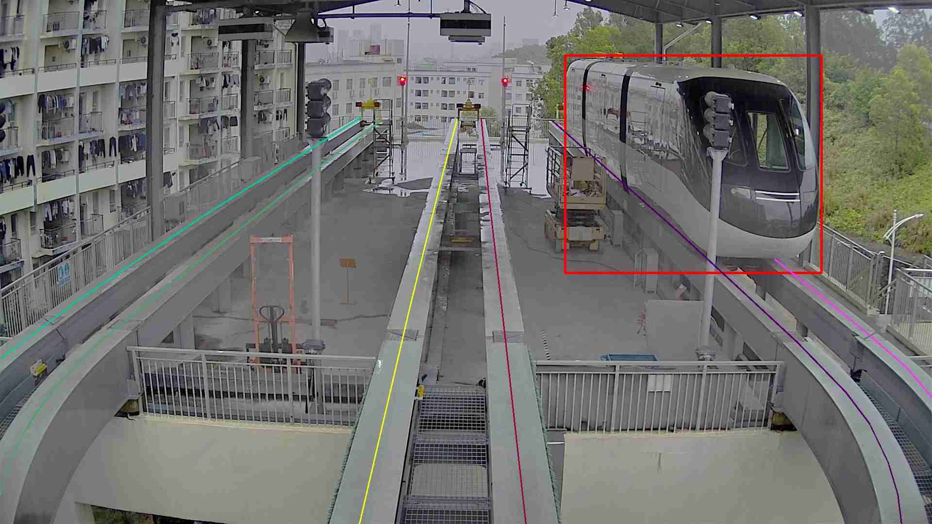
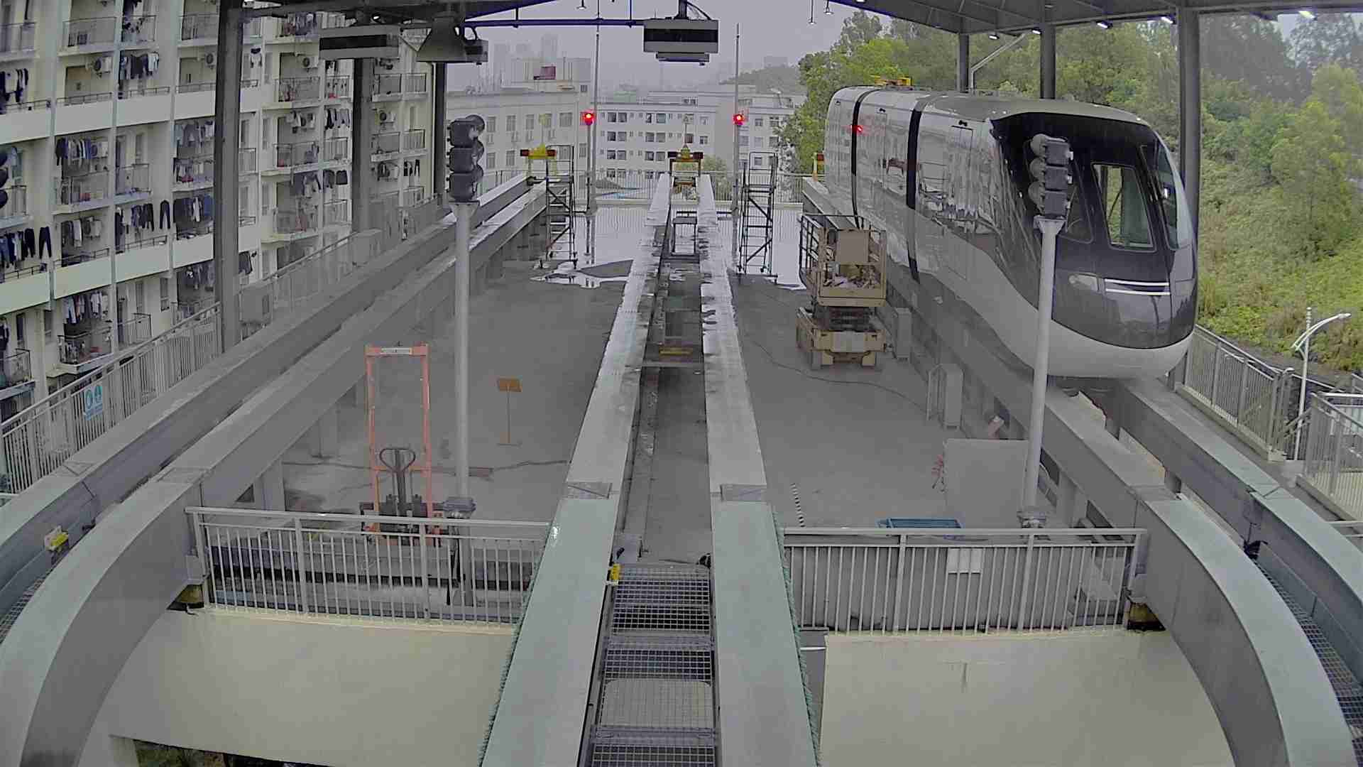
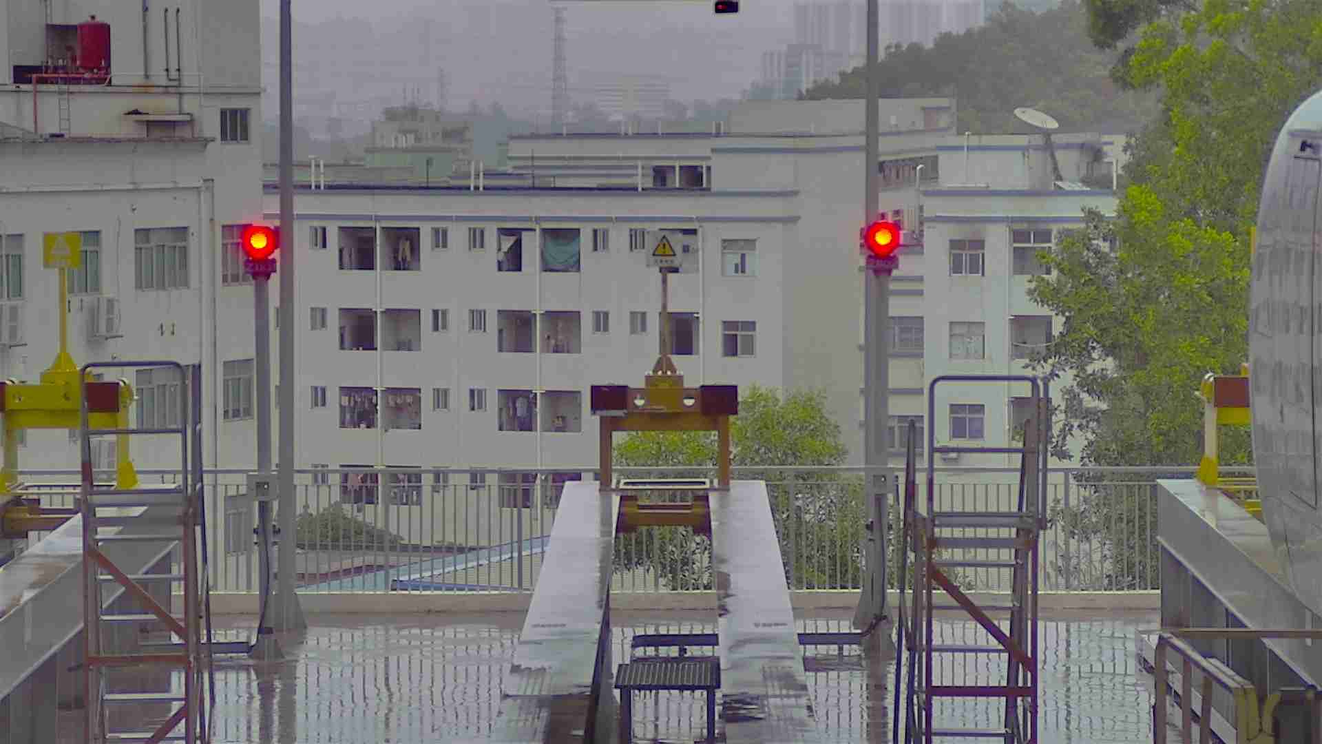
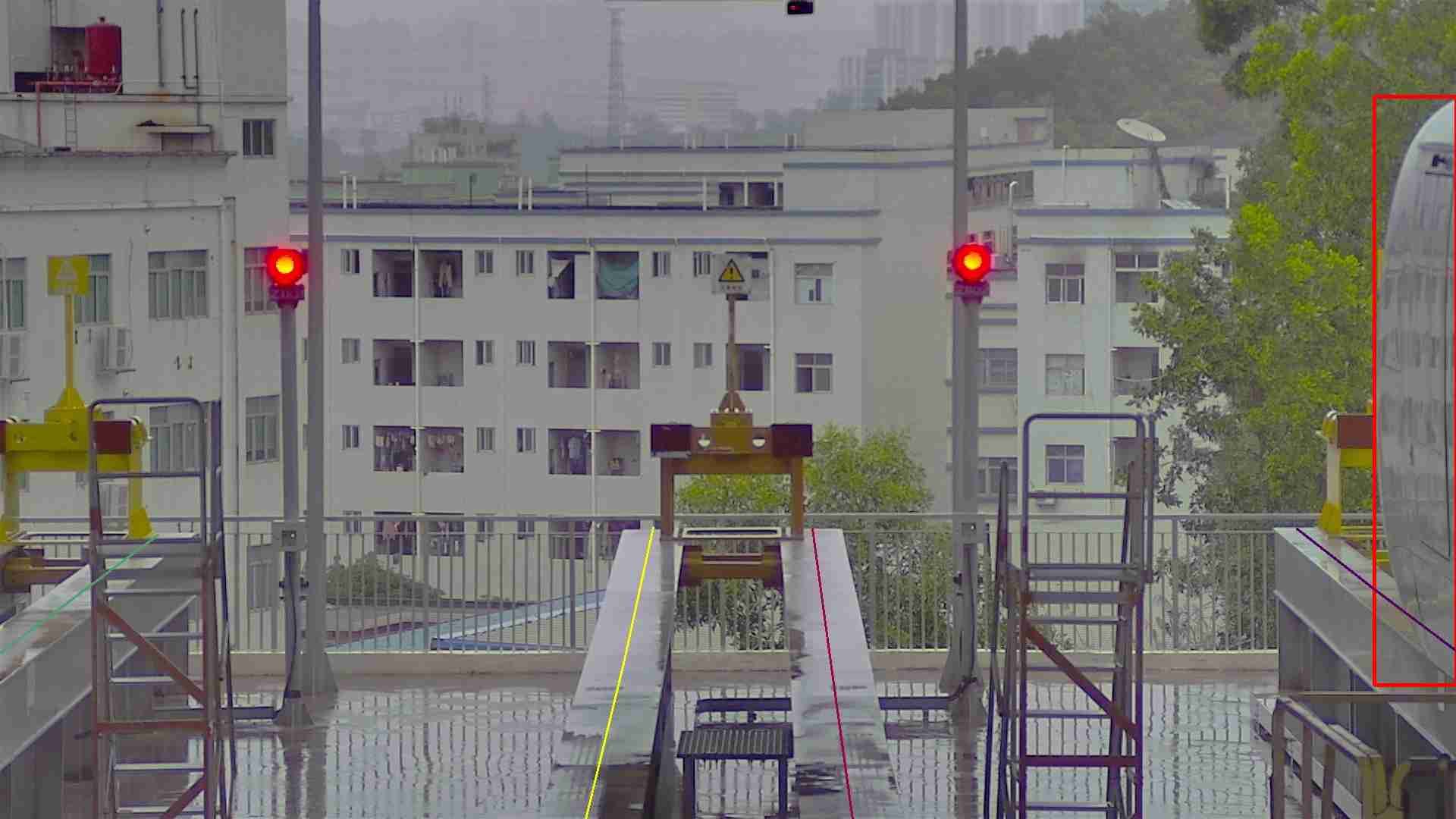
The "Rail Line Labeling Dataset" is tailored for industrial applications, featuring a collection of internet-collected images with a resolution of 1920 x 1080 pixels. This dataset specializes in the detailed labeling of rail lines, including their turns and merges, using polygon annotations. Additionally, trains within these images are labeled with bounding boxes. The dataset specifically focuses on rail networks collected from Wuhan, providing a localized context for rail line analysis and train detection.
Sample
Specification
Dataset ID
MD-Image-081
Dataset Name
Rail Line Labeling Dataset
Data Type
 Image
ImageVolume
About 3k
Data Collection
Internet collected images. Resolution is 1920 x 1080.
Annotation
Polygon,Bounding Box
Annotation Notes
Individual labeling of each rail line, including turns and merges, and label trains with bounding box,collected from Wuhan.
Application Scenarios
Industry
Data Collections
This dataset comprises approximately 3k images, each meticulously annotated to identify individual rail lines using polygon annotations, allowing for precise mapping of rail networks, including specific details such as turns and merges. Trains present in the images are labeled with bounding boxes, facilitating their detection and analysis. This dataset is invaluable for applications within the rail industry, including rail network planning, maintenance, and train tracking systems, offering a detailed visual resource for enhancing rail infrastructure management and operational efficiency.
Quality Assurance
Relevant Open Datasets
To supplement this Dataset, you can explore these open datasets for additional resources:
标题 [Learn more]
简介
Related products
Any further information, please contact us.
